- Home Page /
- Sports Outdoor & Fitness /
- Hunting & Fishing /
- Fishing /
- Tools /
- Charts & Maps /
- Paradise Cay Publications NOAA BookletChart 1...
0 ratings

Item #:
179905054
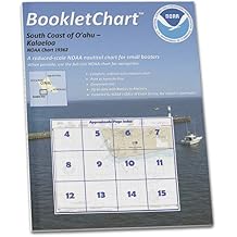
Paradise Cay Publications NOAA BookletChart 19362: South Coast of O'ahu Kalaeloa
Item #:
179905054
JMD 2632
Price Details
Excluding Shipping & Custom charges ( Shipping and custom charges will be calculated on checkout )
*All items will import from US
0 ratings
Write a review
In stock
QTY:
This product is not Fulfilled by Ubuy and can take minimum 10 days in delivery. We might cancel the product from the order and refund you if any issue arise with the delivery of this product.
Secured transaction
Ubuy works hard to protect your security and privacy. Our advanced payment security system ensures confidentiality by encrypting your information during transmission using AES (Advanced Encryption Standards) and SSL (Secure Socket Layer) protocols. Your payment details are 100% secure as we do not share your payment details with third party sellers.
Our Top Logistics Partners
These handy BookletCharts are smaller scale than our traditional paper charts, but they contain most of the information found on a full-scale nautical chart.
Fast
Shipping
Free
Return*
Secure Packaging
100% Original Products
PCI DSS Compliance

ISO 27001 Certified
What Stands Out
Detailed Cartography
This booklet provides intricate and comprehensive maps, ensuring mariners can navigate O'ahu's waters safely and efficiently, catering specifically to local sailing needs.
User-Friendly Format
Designed for convenience, this booklet is lightweight and portable, making it easy for boaters to reference essential navigation information while on the water, enhancing the overall sailing experience.
Accurate Updates
Regular updates and corrections mean this chart reflects the most current navigational data, enabling users to avoid hazards and make informed decisions during their maritime journeys.
Product Details
| Item Weight | 0.2 lbs (90 grams) |
Who Should Buy?

-
Boating Enthusiasts
Ideal for recreational boaters seeking detailed navigational information of O'ahu's south coast.
-
Fishing Professionals
Designed for anglers who need precise charts for effective fishing in local waters around Kalaeloa.
-
Marine Educators
Useful for teachers or educators focusing on marine studies, offering valuable geographical insights and navigation tools.

-
Land Travel
Not suitable for users planning to travel solely by land as it focuses on marine navigation.
-
General Tourism
Lacks broader tourist information that casual visitors may seek for exploring O'ahu's attractions.
-
Inexperienced Navigators
May be challenging for novice navigators who lack basic understanding of marine navigation techniques.
Product Description
Paradise Cay Publications NOAA BookletChart 19362: South Coast of O'ahu Kalaeloa
Have any Query? Chat with us
Customer Questions & Answers
-
Question:
Can I use BookletCharts for commercial vessels?
Answer: No, BookletCharts do not meet chart carriage requirements for regulated commercial vessels. -
Question:
What size are the BookletCharts?
Answer: The BookletCharts are conveniently sized at 8.5 x 11 inches. -
Question:
How are the charts updated?
Answer: Charts are updated based on the latest corrections from the U.S. Coast Guard and other maritime agencies.
Paradise Cay Publications Charts & Maps Editorial Review
No editorial reviews found
Customer Reviews & Ratings
1 customers ratings
-
5 Star
100%
-
4 Star
0%
-
3 Star
0%
-
2 Star
0%
-
1 Star
0%
Review this product
Share your thoughts with other customers
Product Price History
Important information
- Limitations : For products shipped internationally, please note that any manufacturer warranty may not be valid; manufacturer service options may not be available; product manuals, instructions, and safety warnings may not be in destination country languages; the products (and accompanying materials) may not be designed in accordance with destination country standards, specifications, and labeling requirements; and the products may not conform to destination country voltage and other electrical standards (requiring use of an adapter or converter if appropriate). The recipient is responsible for assuring that the product can be lawfully imported to the destination country. When ordering from Ubuy or its affiliates, the recipient is the importer of record and must comply with all laws and regulations of the destination country.
- Not all the products listed on Ubuy are for sale, as Ubuy is a global search engine. Products are subject to export/trade regulations.
JMD 2632
This product is not Fulfilled by Ubuy and can take minimum 10 days in delivery. We might cancel the product from the order and refund you if any issue arise with the delivery of this product.
This item is not restrict in my country.(Please click on above link if this item is not restrict in your country, So our team will review and allow.)
QTY:
Secured transaction
Ubuy works hard to protect your security and privacy. Our advanced payment security system ensures confidentiality by encrypting your information during transmission using AES (Advanced Encryption Standards) and SSL (Secure Socket Layer) protocols. Your payment details are 100% secure as we do not share your payment details with third party sellers.
Our Top Logistics Partners
Fastest cross-border delivery
Features & Benefits
- Conveniently reduced scale for easy handling.
- Contains essential navigation information for boaters.
- Updated with corrections from legal maritime sources.
- Designed specifically for recreational boaters.
- Handy 8.5 x 11 inch size, ideal for small vessels.
- Printed on demand for the latest accuracy and quality.